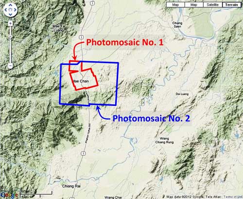
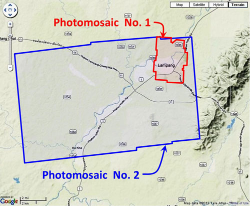
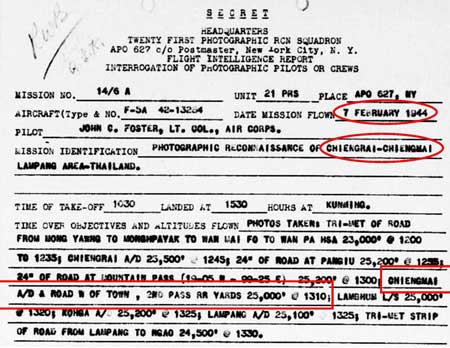
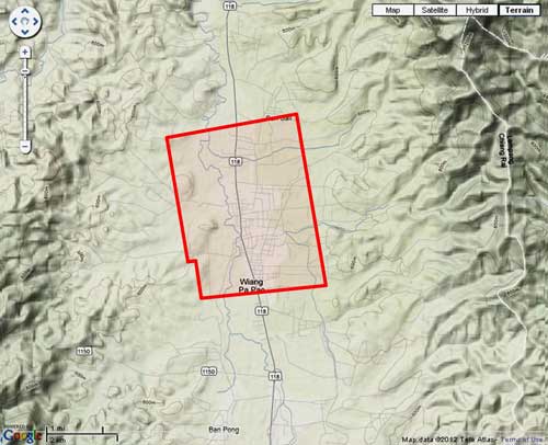
This page discusses World War II aerial photos taken by the Royal Air Force (RAF) and provided on-line by the Geo-spatial Digital Archive Project (GDAP) in its Williams-Hunt Aerial Photograph Digital Collection. 1
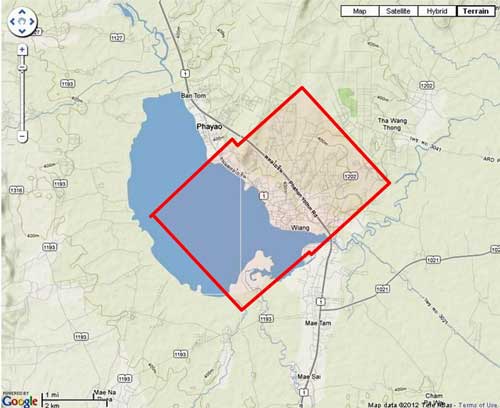
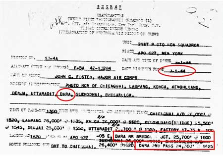
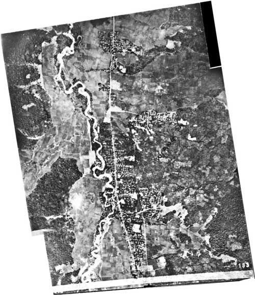
The Williams-Hunt collection has a single set of aerial photos for Pa Pao 2 dated 25 October 1944 3
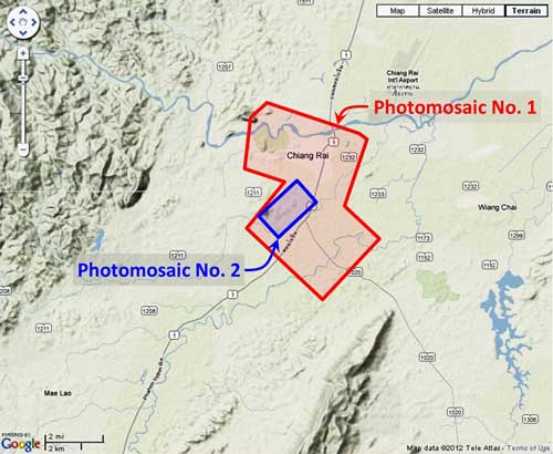
The two-photo aerial photomosaic: 4
 A higher resolution image is available for download here.
The following GDAP images were used in the above photomosaic: 5
and assembled approximately like this, using Microsoft ICE: 6
GDAP, the source of these photos, has asked that the following information be included regarding the aerial imagery shown above:
- Williams-Hunt Aerial Photos Collection
- Original from the School of Oriental and African Studies (SOAS), University of London
- Digital Data from Center for Southeast Asia Studies (CSEAS), Kyoto University
- Digital Archive from Chulachomklao Royal Military Academy (CRMA), Thailand
| First published on Internet | ||
- The collection and its origin are described in detail in:
Lertlum, PhD, Col Surat, and Dr Elizabeth Moore, Williams-Hunt Aerial Photograph Collection, (undated); available as here linked.
Moore, Elizabeth, The Williams-Hunt Collection, Sari – International Journal of the Malay World and Civilisation, 27(2)(2009), pp 265-284.
Periasamy, Makeswary, “A View from the Top“, biblioasia, 5(1) (Apr 2009), pp 38-42.[↩]
- N19°21.50 E99°30.30 Source: Google Earth fix on apparent center of town. [↩]
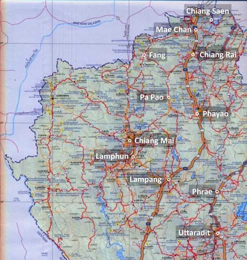
- “Terrain” map from Nations Online Project: Searchable Map and Satellite View of Thailand using Google Earth Data. Annotation (red & blue colored items) were placed by author using Microsoft Publisher.[↩]
- Photos were assembled using Microsoft ICE (Image Composition Editor). The mosaic is oriented so that its north is to the top of the page.[↩]
- The files used here are 1024 KB. Downloading the files which are designated “[full size]” requires a special request form to be emailed to the Head, GDAP.[↩]
- Drawn by author with Microsoft Publisher.[↩]