This page discusses World War II aerial photos taken by the Royal Air Force (RAF) and a US Army Air Force (USAAF) Photographic Reconnaissance Squadron (PR or PRS) and provided on-line by the Geo-spatial Digital Archive Project (GDAP) in its Williams-Hunt Aerial Photograph Digital Collection.1
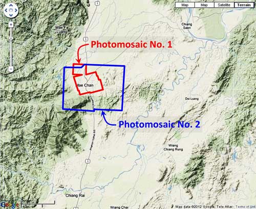
The Williams-Hunt collection has two different sets of aerial photo coverage for Fang: 2 3
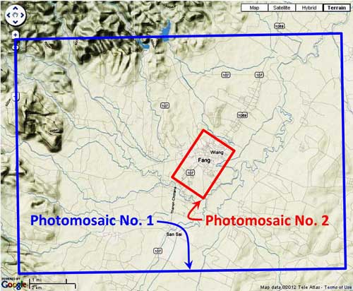
Photomosaic No. 1
An undated two-photo aerial photomosaic: 4
 A higher resolution image is available for download here.
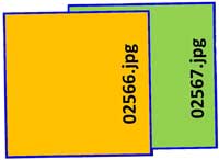
The following GDAP images were used in the above photomosaic: 5
and assembled approximately like this, using Microsoft ICE: 6
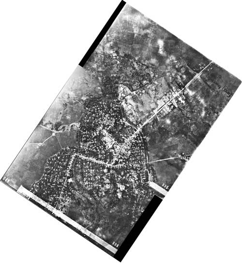
While no date is provided on the images, there is this pointed comment on one, “Petroleum Wells”: 7
![]()
Curiously, a pre-war US intelligence report stated flatly: 8
There are no oil wells in Thailand . . . .
Actually, it would appear that there were no working oil wells in Thailand during the war. Two exploratory wells drilled in the area in 1921 had proven dry, and no further action was taken until 1958. It is curious that the two dry wells had risen in status sometime during the war according to Allied intelligence. 9
In addition, note at the left of the annotation above, “9PR”. Almost all photos in the Williams-Hunt Collection originated with the RAF; however, these two photos were taken by the 9th Photographic Reconnaissance Squadron, a USAAF unit. 10
Photomosaic No. 2
This more detailed study of the immediate Fang area was recorded on two aerial photos dated 24 October 1944: 11
 A higher resolution image is available for download here.
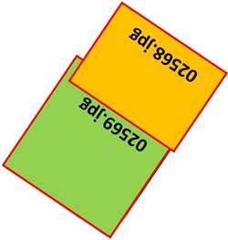
The following GDAP images were used in the above photomosaic: 5
and assembled approximately like this, using Microsoft ICE: 6
GDAP, the source of these photos, has asked that the following information be included regarding the aerial imagery shown above:
- Williams-Hunt Aerial Photos Collection
- Original from the School of Oriental and African Studies (SOAS), University of London
- Digital Data from Center for Southeast Asia Studies (CSEAS), Kyoto University
- Digital Archive from Chulachomklao Royal Military Academy (CRMA), Thailand
| First published on Internet | ||
-
The collection and its origin are described in detail in:
Lertlum, PhD, Col Surat, and Dr Elizabeth Moore, Williams-Hunt Aerial Photograph Collection, (undated); available as here linked.
Moore, Elizabeth, The Williams-Hunt Collection, Sari – International Journal of the Malay World and Civilisation, 27(2)(2009), pp 265-284.
Periasamy, Makeswary, “A View from the Top“, biblioasia, 5(1) (Apr 2009), pp 38-42.[↩]
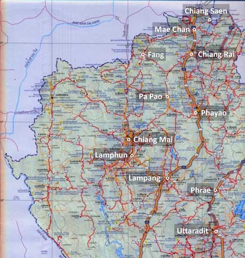
- N19°55.25 E99°12.80 Source: Google Earth fix on apparent center of town. [↩]
- “Terrain” map from Nations Online Project: Searchable Map and Satellite View of Thailand using Google Earth Data. Annotation (red & blue colored items) were placed by author using Microsoft Publisher.[↩]
-
Photos were assembled using Microsoft ICE (Image Composition Editor).
Mosaic has been oriented so that its north points to the top of the page.[↩]
- The files used here are 1024 KB. Downloading the files which are designated “[full size]” requires a special request form to be emailed to the Head, GDAP.[↩][↩]
- Drawn by author with Microsoft Publisher.[↩][↩]
-
Extract from GDAP image 02566.jpg.
[↩]
- A Survey of Thailand (Siam), (Washington: US War Department, March 15, 1941) Section V: Economic, 40. Manufacturing, b. Oil, p 23 (USAF Archive Reel A2874, p 1389). [↩]
- Nopparat Settakul, “Fang Oilfield Development“, Walailak Journal of Science & Technology, (2009: 6(1) 1-15), p 5. [↩]
- The annotation begins with a starting parenthesis:
(9PR 5MH55-?????).
See FOTO JO IN CBI for more information on the 9th PRS.[↩] -
Photos were assembled using Microsoft ICE.
Mosaic has been oriented so that its north points to the top of the page.[↩]