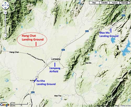
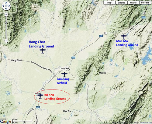
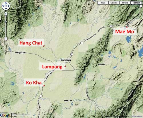
Lampang Airfield Group
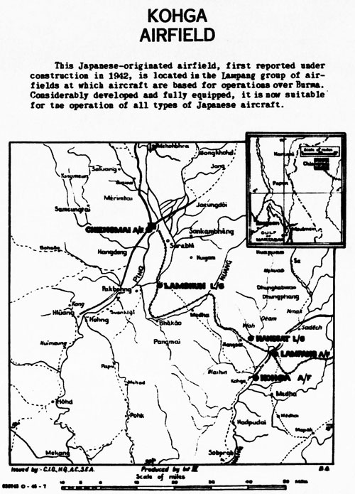
The Lampang Airfield Group might today be termed the Northern Thai Air Defense Command with Lampang1 as its center. At the time, it was apparently developed to support the plans of the Imperial Japanese Army (IJA) to defend Burma, then to invade India, and finally to defend Thailand itself. The development included, first, improvements in the existing airfields at Lampang and Ko Kha, and later, the establishment of two new airstrips at Mae Mo and Hang Chat. While the Allied interpretation of the group did not include the more distant airfields in northwest Thailand of Chiang Mai, Chiang Rai, Phrae, Nan, and Kengtung, they were nonetheless subordinate to Lampang.
While IJA ground forces made the improvements dictated by higher command in anticipation of the arrival of new aircraft, Japan’s industry, under onslaught from Allied air attacks, was unable to provide such aircraft. In fact, no aircraft would ever be sighted at Ko Kha, Mae Mo, or Hang Chat air facilities during Allied overflights.2
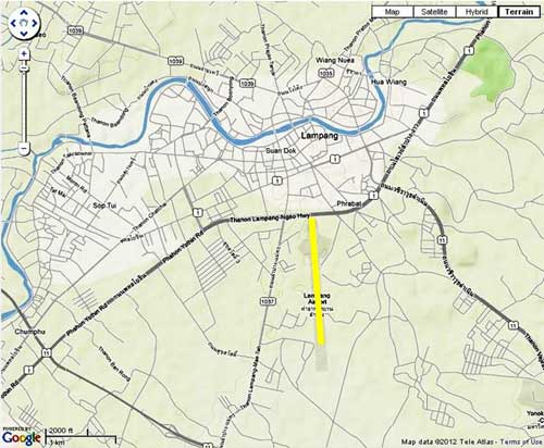
Lampang was an important transport hub in northwest Thailand at the beginning of the war; facilities there included:
- An airstrip.(though without scheduled connections listed)
- A rail connection to Bangkok and its Khlong Toei harbor facilities, 600+ rail-km south,3 with express passenger service scheduled twice a week.4
- The main north-south road (Phahonyothin Road, now Route 1), providing connections:
- To the north, the border towns of Thailand’s Mae Sai and Burma’s Tachileik, 282 road-km distant, with access north to Kengtung in Burma.
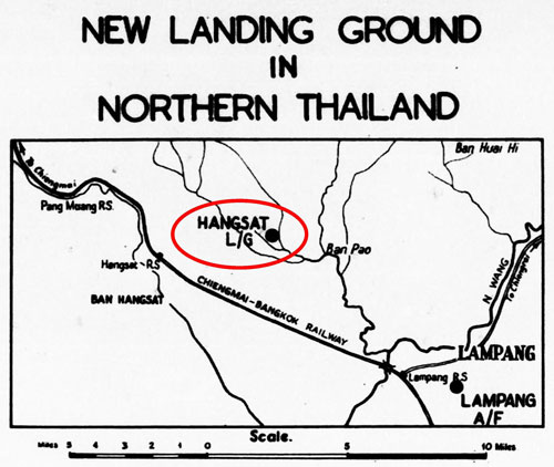
- To the immediate south, Ko Kha with Thailand’s first sugar refinery, about 15 road-km distant. Ko Kha also had an airstrip, for reasons as yet unclear. The next major town to the south with an airstrip was Phitsanulok.
In 1944, two more airstrips were added to the Lampang Airfield Group, at:
- Hang Chat: about 17 road-km to the northwest
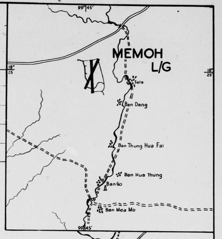
- Mae Mo: about 31 road-km to the northeast
In larger scale:5

Each air facility is discussed in more detail under these individual headings:
| First published on Internet | ||
| Explanatory text plus larger map added | ||
| Converted to WordPress by Ally Taylor | ||
| Updated, author errors & typos corrected | ||
- Lampang, N18°16 E99°30 (Coordinates per Google Earth for current location of Lampang airport), is located at the junction of major Thai Highways 1 and 11.[↩]
- “Terrain” map from Nations Online Project: Searchable Map and Satellite View of Thailand using Google Earth Data (website no longer active). Annotations by author using Microsoft Publisher.[↩]
- Whyte, BR, The Railway Atlas of Thailand, Laos and Cambodia (Bangkok: White Lotus, 2010), p 28.[↩]
- 2bangkok forum thread: “Train schedule Dec 1941” (a useful reference (one of many) was lost when 2bangkok.com was hacked several years ago.[↩]
- “Terrain” map, ibid.[↩]